
Edmonton LRT map
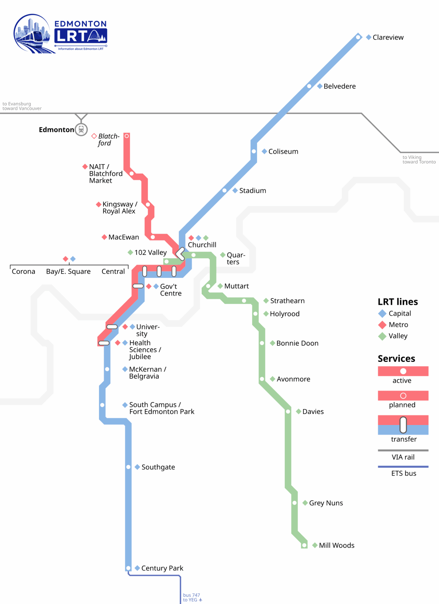
The full Edmonton LRT system diagram — view it here, or download the PDF so it works underground with no signal.
Download the Edmonton LRT map (PDF)
Save the full Edmonton LRT map as a PDF so it stays sharp at any zoom and works with no signal — handy in the underground downtown stations. It shows all three lines, every station and the downtown transfers on one page.
Reading the map
The network line by line
Map questions
Right here — it stays sharp at any zoom, so it is worth saving to your phone before you head into the underground downtown stations where you may lose signal.
It is a community diagram published under a CC0 (public-domain) licence on Wikimedia Commons, which we checked against the City of Edmonton’s own 2025 LRT network map. The precise station order, journey times and frequencies on this site come from the ETS GTFS feed, not from the picture. For the operator’s own map and for live alerts, go to edmonton.ca/ets.
29 in total across the three lines. That is the count from the ETS schedule feed this site is built from — the same number you can count on the line pages here. The map shows the Metro Line extension to NAIT with Blatchford Gate marked as planned, and it does not yet include the future Valley Line West.
Yes. Through the seven downtown-and-university stations from Health Sciences/Jubilee up to Churchill, the Capital and Metro lines run on the same tracks and platforms. North of Churchill they split — Capital heads northeast toward Clareview, Metro heads northwest toward NAIT. On any shared station you simply board whichever train comes first. The Valley Line is a separate street-running system and only connects on foot at Churchill.